Tag Archive for: Mini

Mini-Flood 89: Illinois Caverns State Natural Area

Mini-Flood 89: Illinois Caverns State Natural Area

photo by Lina Walz-Salvador Illinois Caverns State Natural Area, formerly Burksville Cave, Mammoth Cave of Illinois, Egyptian Cave and Eckert’s Cave, is the largest cave in Illinois open for public tours. This showstopper was originally thought to be larger than Mammoth Cave in Kentucky and features a variety of...

Continue reading

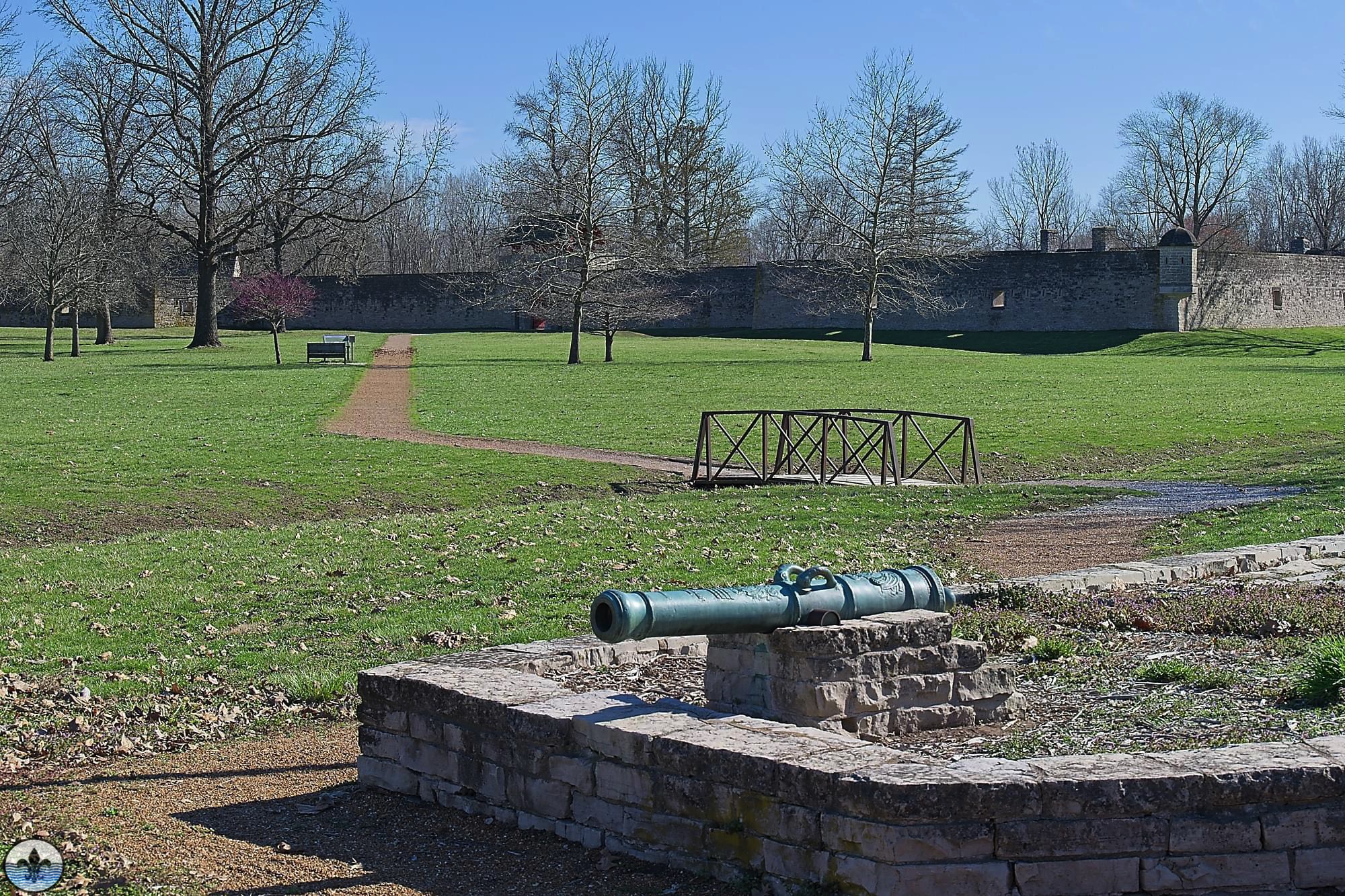
Mini-Flood 87: Fort de Chartres State Historic Site

Mini-Flood 87: Fort de Chartres State Historic Site

photo by Mark McKeown Site of the original French Colonial fort and later occupied by the British, Fort de Chartres is today a faithful recreation of what European life in the Mississippi Valley was really like. photo by Sue Rakers

Continue reading

Mini-Flood 82: St Charles Rock Road

Mini-Flood 82: St Charles Rock Road

photo by Valerie Rippey St Charles Rock Road is a major thoroughfare in northwest St. Louis County, and many relics of its long and glorious history are still visible. Before we explore, here’s a little historical background… St Charles Rock Road was the first road to traverse St. Louis...

Continue reading

Mini-Flood 81: Historic Route 66

Mini-Flood 81: Historic Route 66

photo by Joe Rakers Route 66 was immortalized by John Steinbeck who called it “the mother road” in The Grapes of Wrath.  It inspired a hit song (“Get your kicks on Route 66”) and a TV show (“Route 66”).  The Phillips 66 Company is named after Route 66, where...

Continue reading

Mini-Flood 80: Quarantine

Mini-Flood 80: Quarantine

photo by Ann Aurbach Friends and readers, we’ve had some unusual days as of late, but no matter what the universe has thrown our way over the last 7.5 years, Photo Flood Saint Louis has never shied away from documenting it. It was therefore imperative that we do something...

Continue reading

Mini-Flood 79: Natural Bridge

Mini-Flood 79: Natural Bridge

photo by Sue Rakers Natural Bridge Road – so named because it once utilized a natural limestone bridge to cross over Rocky Branch Creek in the city – is one of the original (1840’s) major thoroughfares of north St. Louis, starting deep in the city and making a nearly...

Continue reading

Mini-Flood 78: North Kingshighway

Mini-Flood 78: North Kingshighway

photo by Dave Adams The purpose of this walk was to explore the 1.3-mile section of the Kingshighway thoroughfare that stretches from Interstate 64 to Delmar Blvd, i.e., the section of Kingshighway that traverses the Central West End (CWE).  But if you think that means this is a homogeneous...

Continue reading

Mini-Flood 77: South Broadway

Mini-Flood 77: South Broadway

photo by Ingrid Borecki On most of our street walks we have seen the results of a boom-to-bust-to-boom cycle.  In the case of South Broadway through the Patch and Carondelet neighborhoods in the far south end of the city, we are still waiting for the rebound.  One major factor was...

Continue reading

Mini-Flood 76: The Grove

Mini-Flood 76: The Grove

photo by Maureen Minich On this street walk, we explored a lively section of Manchester known as The Grove, in the center of the Forest Park Southeast (FPSE) neighborhood, which we successfully flooded on a beautiful Spring morning in 2015. We wanted to come back and focus on The Grove...

Continue reading

©2024 Photo Flood Saint Louis

Log in with your credentials

or    

Forgot your details?

Create Account