Mini-Floods
Mini Flood 91: Paint Louis 2025

Photo by Joe Rakers The weather this year for Paint Louis 2025 was perfect. It wasn’t too hot and the humidity was tolerable for the first time in years. The 3 day event, which happens on Labor Day weekend was in full swing this year. It is the largest...
Mini-Flood 90: Eads Bridge
photo by Sue Rakers St. Louis’ Eads Bridge is among the most iconic structures of the city. As the world’s first steel, arch bridge, Eads impresses in both form and function (though it was not first, it is now the oldest bridge across the Mississippi River). In 2024, the...
Mini-Flood 89: Illinois Caverns State Natural Area
photo by Lina Walz-Salvador Illinois Caverns State Natural Area, formerly Burksville Cave, Mammoth Cave of Illinois, Egyptian Cave and Eckert’s Cave, is the largest cave in Illinois open for public tours. This showstopper was originally thought to be larger than Mammoth Cave in Kentucky and features a variety of...
Photo Floods
Photo Flood 142: Compton Heights
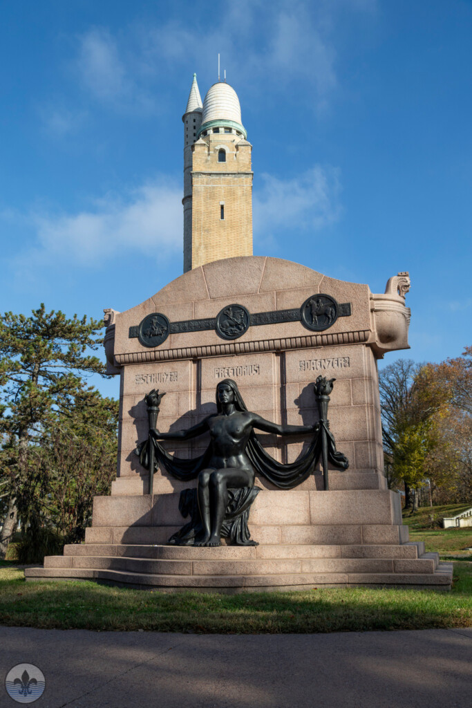
Photo by Mike Matney Dominated by its magnificent water tower Compton Heights is one of the earliest examples of a planned residential development of the 19th Century in the United States. The neighborhood was first visited by Photo Flood STL back on June 16th, 2016. The article for that visit...
Photo Flood 141: Fox Park
Photo by Sue Rakers The Fox Park neighborhood was first visited by Photo Flood STL on October 21st, 2017 during Flood 62. Tucked away between Compton Heights and Tower Grove East to the west, and McKinley Heights to the east, Fox Park was settled by German immigrants in the...
Photo Flood 140: Maplewood
Photo by Jennifer Smith The city of Maplewood sits along the western border of St. Louis and is part of St. Louis County. The history of the Maplewood dates to the 1800s and includes ties with the Chouteau family known for their role in St. Louis history. A...


