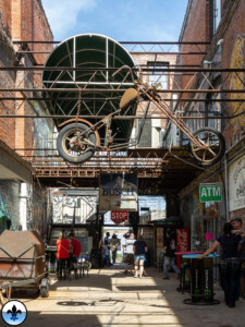
photo by Maureen Minich Near North Riverfront is a bastion of St. Louis’ past industrial might, so much so, that any stroll through the neighborhood could be considered a walk through a veritable museum of manufacturing. Many big businesses, like Proctor and Gamble, still call the area home for their...
Author Archive for: Dave Adams
Photo Flood 117: Near North Riverfront
Photo by Jen Smith Near North Riverfront is not a neighborhood in the conventional sense of the word, it is a long strip of sparsely populated land that is primarily composed of industrial, commercial, and abandoned real estate that lies between the Mississippi River and the stretch of parallel...
Photo Flood 114: Old North Saint Louis
photo by Jeff Phillips Old North Saint Louis (ONSL) is a historic, resilient neighborhood. Geographically, it is shaped roughly like a rectangle (actually, like a parallelogram). The border of the short end at the top is Palm, which separates ONSL from the architectural crown jewel Hyde Park. Palm, incidentally,...
Tower Grove Park
photo by Yvonne Suess Donated to the city in 1868, Tower Grove Park is one of St. Louis’ best-loved green spaces. Second in size only to Forest Park, TGP provides recreation for some of the city’s most active neighborhoods. Originally designed after Victorian examples in England, the park is laid...
Photo Flood 112: Tower Grove Park
Photo by Thomas Gremaud Henry Shaw was born in England in 1800. In 1818 he accompanied his father, an industrialist, to Canada on a business trip. The very next year, the young Shaw was dispatched to New Orleans alone on business, and from there he traveled on a riverboat (“The...
Mini-Flood 82: St Charles Rock Road
photo by Valerie Rippey St Charles Rock Road is a major thoroughfare in northwest St. Louis County, and many relics of its long and glorious history are still visible. Before we explore, here’s a little historical background… St Charles Rock Road was the first road to traverse St. Louis...
Photo Flood 110: Soulard
photo by RJ Wilner The music from the brass instruments began to emanate from the plaza outside the farmer’s market and reverberate through the old brick neighborhood late on a beautiful Saturday afternoon, quickly drawing onlookers; and then, as the second-line brass band (pictured above) marched the wedding party...
Mini-Flood 81: Historic Route 66
photo by Joe Rakers Route 66 was immortalized by John Steinbeck who called it “the mother road” in The Grapes of Wrath. It inspired a hit song (“Get your kicks on Route 66”) and a TV show (“Route 66”). The Phillips 66 Company is named after Route 66, where...
Mini-Flood 79: Natural Bridge
photo by Sue Rakers Natural Bridge Road – so named because it once utilized a natural limestone bridge to cross over Rocky Branch Creek in the city – is one of the original (1840’s) major thoroughfares of north St. Louis, starting deep in the city and making a nearly...
Mini-Flood 78: North Kingshighway
photo by Dave Adams The purpose of this walk was to explore the 1.3-mile section of the Kingshighway thoroughfare that stretches from Interstate 64 to Delmar Blvd, i.e., the section of Kingshighway that traverses the Central West End (CWE). But if you think that means this is a homogeneous...