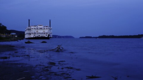
photo by Dave Adams
The purpose of this walk was to explore the 1.3-mile section of the Kingshighway thoroughfare that stretches from Interstate 64 to Delmar Blvd, i.e., the section of Kingshighway that traverses the Central West End (CWE). But if you think that means this is a homogeneous stretch of road, then you are in for a surprise, as this walk exposed us to disparate environs: A major urban medical center, a glorious park that is even larger than New York’s Central Park, high-rise apartment communities, elegant private “places”, and a cluster of churches. This was a great walk for street photography, nature, and architecture.

photo by Florence Flick

photo by Maureen Foley Minich
Kingshighway started as an Indian trail and then became a road separating the village’s common fields from the King’s domain, hence the name Kingshighway. Today, it is a major corridor that nearly bisects the city from north to south. Kingshighway itself is bisected by Interstate 64. Oddly, the directional prefix changes three times within the CWE: North of Washington Pl / Blvd (a small street) it is denoted as N Kingshighway, south of Laclede Ave (another small street) it is S Kingshighway, and in between it is just Kingshighway (neither N or S).
Interstate 64 enforces the southern boundary of our walk and of the CWE. If you have been following along you know that the consequences of the construction of the interstate highway system mandated and funded by the Federal Aid Highway Act of 1956, is one of the recurring themes of this series of articles. For example, in our previous street walk, down South Broadway, we saw that the neighborhood of Carondelet has never really recovered since Interstate 55 sliced through it – not only leveling homes but also splitting the neighborhood and leaving a large part isolated from the rest of south city. However, that was not the case here because Interstate 64 was laid down on top of the existing Highway 40. (Which is why most St. Louisans still refer to I-64 simply as “forty”.) Indeed, it appears that this area has benefitted from its proximity and easy access to the interstate.
Walking north on Kingshighway from the interstate, the skyline is dominated by Washington University Medical Center on the right (see the picture above and the picture below). This institution has been a stabilizing force since WWI, and presumably one of the reasons why the CWE did not suffer as badly as the rest of the city during its precipitous post-WWII decline. (And we will discuss other stabilizing forces later in this article.) In the 1970’s the medical center decided to stay put instead of moving to the county, and this is said to be a turning point for the CWE, helping to ensure its place as one of the finest neighborhoods in the city.

photo by Susan Price
But to help protect their investment, they created the Washington University Medical Center Redevelopment Corporation (WUMCRC). If you recall from our walk down The Grove in the neighboring Forest Park Southeast neighborhood, this was a major factor in the renaissance of that area. Founded in 1974 to upgrade and stabilize 38 square blocks surrounding the medical center, WUMCRC buys dilapidated or underused properties and sells them to developers, helps to relocate displaced residents, and works with the city to improve the streets and lighting. According to their web site, they are “a partnership between BJC Health Care and Washington University School of Medicine and works to improve the quality of life for the neighborhoods surrounding the medical campus. In order to achieve this goal in Forest Park Southeast and the Central West End , WUMCRC has invested millions of dollars toward regenerating the market for private investment in businesses and real estate, enhancing human and social service opportunities, and improving the level of physical and personal security.” Following their lead, St. Louis University in 2017 created the Midtown Redevelopment Corporation to improve the 400 acres surrounding their new $550 million hospital construction project.

photo by Dawn Wilcox

photo by Ryan Stanley
Across the street is one of St. Louis’ greatest treasures, Forest Park (pictured above and below). For this walk we picked a date and time with the fall foliage in mind, and luckily mother nature cooperated, giving us a great opportunity to capture a taste of its glory.
The park opened in 1876 and was immediately popular but it was a 40 minute carriage ride from downtown. It did not become easily accessible to the general public until a streetcar line reached it in 1885. In the 1890’s, the streetcars transported nearly three million visitors a year to the park. Today, Interstate 64 provides even easier access.
Forest Park was the site of the spectacular and influential 1904 World’s Fair and is now home to one of the nation’s best zoos, an excellent art museum, and much more. We could do a flood of just Forest Park. In fact, we have. Twice: http://www.photofloodstl.org/forest-park-photo-flood/

photo by Dave Adams

photo by Joe Harrison

photo by Ryan Stanley
As we pass Forest Park Ave, the landscape on the left is still Forest Park, but on the right it changes from the medical center to high-rise apartments buildings. Joining this group of old, stately, picturesque buildings is a spectacular new tower. Our group of photographers was captivated by the abstract, futuristic design of the One Hundred Luxury Apartments currently under construction (see picture above and below, and also the second picture in the article).

photo by Dawn Wilcox

photo by Ryan Stanley

photo by Maureen Foley Minich

photo by Joe Harrison
Passing Lindell Blvd, on the right is the Chase-Park Plaza (pictured above). Originally separate hotels built in the 1920’s, they combined in 1961. For many years they remained at the pinnacle of St. Louis society but in the 1980’s suffered from increased competition from new and renovated hotels downtown. The Chase closed and the Park Plaza was converted to luxury apartments and offices in 1989. The contents of the Chase were auctioned off amid great uncertainty for the future of the property, but a developer successfully renovated and re-opened the property in 1999 with the help of state and federal historic tax credits.

photo by Maureen Foley Minich

photo by Florence Flick
We are now north of Forest Park and in the land of “private places” (pictured above and below). You may recall our Locust Street walk earlier this year where we learned of Lucas Place, which was the first St. Louis private place, and in effect the first western suburb. It was located just west of Tucker, then the boundary of the entire city – which now is considered to be just the Downtown neighborhood. Lucas Place was relatively short-lived as it was quickly overtaken by the city’s westward expansion. Lucas Place residents continued westward, and some of them (such as T. S. Eliot’s parents) helped to establish these new private places in the CWE. Lucas Place disintegrated and all residences were demolished and replaced with commercial buildings. (Except for the remarkable Campbell House, and that remains only due to a tragic twist of fate.) The private places in the CWE, however, have survived with their original character and grandeur largely intact, “an outdoor museum of American domestic architecture designed for the wealthy” in the words of the Landmarks Association. They formed the original core of the CWE and have been another of the stabilizing influences helping to prevent the CWE from declining as badly as most of the city did during the post-WWII depopulation.

photo by Florence Flick
It began with Westmoreland and Portland Place in the 1880’s. These were laid out by former city engineer Julius Pitzman who designed Vandeventer Place and Compton Heights. Their success spawned other “places” in the area. For example, Hortense Place was established in 1900 by Jacob Goldman, a cotton manufacturer who decided to create his own private place (and name it after his daughter) after being refused admission to Portland and Westmoreland places because he was Jewish. The more modest Lenox Place was developed in 1903 and many residents were children of Portland and Westmoreland place residents.
Improving the surrounding area is one reason these private places have persisted while many predecessors such as Lucas Place succumbed to urban sprawl. They built upscale hotels and apartments on Kingshighway, purchased nearby rail yards, and so on. This is analogous to mission of WUMCRC. Not to question their altruism, but they are also protecting their investment.

photo by Ryan Stanley
Next, on the left, we encounter the Central Reform Congregation on the southwest corner of Kingshighway and Waterman and the First Unitarian Church directly across the street on the northwest corner of the intersection. Then at the next intersection we encounter the “Holy Corners” – three churches, a synagogue and a lodge that were built between 1902 and 1908 at the intersection of Kingshighway with Washington, McPherson and Westminster, and listed on the National Register of Historic Places in 1975. Two of those buildings are still owned by the original organization and are still used for the same purpose.
- First Church of Christ, Scientist, at the southwest corner of Kingshighway at Westminster Place broke ground in 1903 and opened in 1904 in time for the world’s fair. It was founded in 1894 as the first Christian Science congregation west of the Mississippi, and one of the first five in the world. Christian Science is headquartered in Boston. This property still houses its original congregation. By the way, across the street (Kingshighway) on the left is the Racquet Club, built in 1906 and still in operation. They sponsored Charles Lindbergh’s famous flight with a $10,000 donation.
- The Tuscan Temple, northwest corner of Kingshighway at Westminster Place, 1907/8, headquarters of the Tuscan Lodge 360. The property is still held by the original owner, a local order of the Freemasons fraternal association, which meets there twice a month.
- St. John’s Methodist Episcopal, southwest corner of Kingshighway at Washington Place, 1901-1903 was designed by Theodore Link who also designed Union Station. Their last service was in December 2007. The congregation dissolved due to decreasing participation. The building was mostly vacant until occupied by Link Auction Galleries which, according to their web site, “was formed in January, 2014 by a team of specialists with a combined total of over 160 years of experience in the St. Louis auction industry. Our company takes its name from Theodore Link, the German/American architect who designed our historical building at 5000 Washington Place in St. Louis’ vibrant Central West End. Our group aims to preserve the institution of a full-scale auction house that St. Louis has been fortunate to maintain since 1830. At the same time, we are preserving a 1902 Greek Revival style landmark that was the first building in St. Louis listed on the national historic registry.”
- The Second Baptist Church (pictured above) is across the street, between McPherson Ave and Washington Blvd. They purchased the land in 1902, broke ground in 1906, opened in 1907. The upper 60 feet of the tower had to be removed in the 1950’s because they could not afford to maintain it. Second Baptist Church owned the property until the congregation moved to St. Louis County in 1955. It then became the Gospel Assembly Pentecostal Church until the mid-1970s, and then Baptist Church of the Good Shepherd, which became the Life Cathedral Word of God Baptist Church in 1982. Developer Pete Rothschild bought the building in 2008 for $1.3 million but then the recession hit and his plans for an event space in the sanctuary and apartments in the smaller chapel have moved did not materialize, despite spending $600,000 with the help of tax credits. Today the property is vacant and in poor condition.
- Temple Israel (pictured below) at the northwest corner of Kingshighway at Washington Place opened in 1907 and moved to the county in 1962. It is now the Angelic Temple of Deliverance, aka Angelic Temple of Deliverance United in Worship Deliverance Center. An education building was added in 1931. That building, known as Temple Israel House, later housed Metro Classical High School until 2008 and was renovated for commercial use, currently housing several small businesses.

photo by Joe Harrison

photo by Susan Price

photo by Dave Adams
By the way, across the street (Kingshighway), the Washington Hotel was one of the most expensive buildings in the area and it was built specifically for the World’s Fair. In 1979 it was converted to housing and is now called the Washington Apartments.
Finally, we reach Delmar Boulevard and the end of our walk. Whereas the interstate that demarks the southern boundary is a formidable physical barrier, Delmar is more of a psychological barrier.
In addition to all that we saw on our walk up Kingshighway, there is still so much more to the CWE. In fact, we had to subdivide it into two floods: http://www.photofloodstl.org/central-west-end/