photo by Sue Donovan
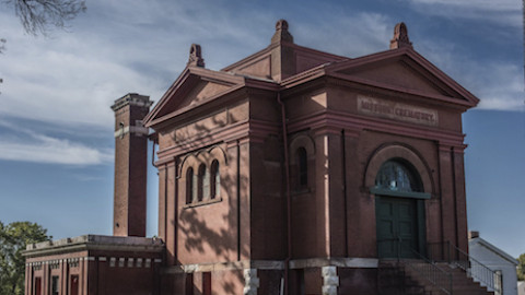
Southampton is perhaps the best, least-guarded secret gem in St. Louis. A seemingly sleepy residential neighborhood, with the city’s most notable collection of STL style gingerbread houses, harbors a charming commercial corridor on the upswing at its heart.

photo by Sue Donovan

photo by Mike Matney

photo by Maureen Minich

photo by Jason Gray
For most of the 1800’s, the area of Southampton was a collection of rural farms spread out across rolling countryside. Largest of them and most prominent was Everard Horton’s, which is why many of the streets and the neighborhood itself have British names (Horton settled here from England). Though the neighborhood would remain undeveloped longer than most of those that surround it, a set of factors for development eventually proved too compelling to deny.

photo by Vivian Nieuwsma

photo by Joe Harrison

photo by Mike Matney

photo by Jason Gray

photo by Jackie Johnson
After World War I, St. Louis was on another upswing in commercial and residential development (between 1900 and 1930, the city added almost as many people to its population as there are in total living in the city today). This activity was extending the boundaries of what was considered “urban” to especially the far southwest and northwest areas of the city.
For Southampton during this time, development was occurring seemingly all around it, simultaneously. St. Louis Hills was being quickly converted and commodified as “country estates” to its west, while the new Chippewa Street Car line (and later, U.S. Route 66) brought commercial development along its northern border (the Hampton Village Shopping Center, with its distinctive Neo-colonial motif went up in 1939 as a direct result), and the Kingshighway Commission (envisioned by famous architect and city panner George Kessler to create a “green ring” of wide boulevards to encircle the city) extended development along the neighborhood’s eastern border. It’s perhaps no surprise then that the Southampton neighborhood would emerge from its rural tradition into its current urban one in just a few short years, between World War I and II.

photo by Sue Donovan

photo by Mike Matney

photo by Jason Gray

photo by Maureen Minich

photo by Joe Harrison
Southampton’s growth occurred during a time when American fascination with the automobile was increasing exponentially. With this in mind, the street grid of the neighborhood was laid out in such a way as to accommodate this trend. Nonetheless, the area remained (and remains) incredibly walkable.
Today, Southampton is one of the city’s most desirable and safest neighborhoods, but this statement does quite summarize it either. It is desirable because it is safe, sure, but it is safe largely due to how stable it is (very high occupancy rate, with a sustainable mixture of owned vs. rented living spaces). I think a large reason why people stay in this neighborhood is because of an undefinable “charm”- it has great amenities for shopping and dining (including the perennially chill-vibed Macklind strip mentioned at the opening of this article), its housing is old enough and small enough to be easily maintained (great looking and scaled to not be prohibitively expensive), its proximity is great, both to downtown and to the suburbs, and it lacks the pretension of some other neighborhoods nearby.
If you have yet to discover these charms for yourself, why not stop in and see soon?

photo by Jackie Johnson

photo by Sue Donovan

photo by Maureen Minich

photo by Joe Harrison

photo by Sue Donovan
Map is available here.


