
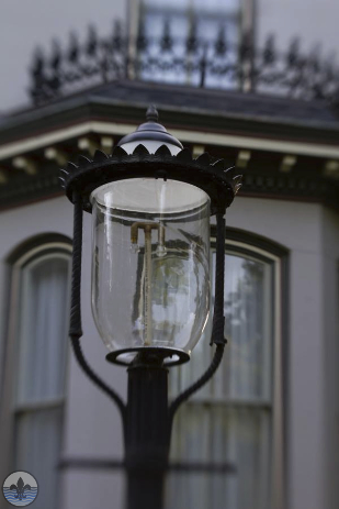
photograph by Jamie Kreher
One of the city’s most distinctive neighborhoods, Lafayette Square has a varied and extremely interesting history. The park at its center is the oldest public park in St. Louis, and has been met with challenges ranging from bandits to tornados and cholera. The neighborhood is known internationally for its excellent collection of Victorian era “painted ladies”, and as a successful example of redevelopment in the city.

photograph by Dan Henrichs Photography, St. Louis

photograph by Ann Aurbach

photograph by Jason Gray

photograph by Jason Gray

photograph by Mandi Gray

photograph by Brett Williams
Some time after St. Louis’ settling as a French colony in 1764, the land comprising Lafayette Square was allocated for use as a common pasture. This open field system of subsistence farming has its roots in medieval Europe, and is characterized by large swathes of land at the border of towns or villages, wherein those residing are designated some space for growing food or raising livestock. In the case of Lafayette, the area was primarily used for grazing animals. However, in the early 1800’s, the common pasture had became a place of refuge for gangs of bandits, who used the relative seclusion of the open land to stage robberies of travelers and farmers alike. In 1835, the state supported the municipality’s bid to sell off the common lands for private development, a gesture meant at thwarting the area’s ravaging villains. James MacKay, a furrier and surveyor who supplied maps to the Lewis and Clark Expedition, was among the first wave to own property in the neighborhood. His home included a fieldstone structure (apparently quarried onsite), which was originally an outbuilding constructed by Joseph Motard who had his portion of the pasture on the land surrounding. This building, now a home, is the only extant French Colonial building known to exist in St. Louis, and is theorized to date back to the late 1780’s.

photograph by Jeni Kulka

photograph by Jason Gray

photograph by Jason Gray
As the common pasture quickly began to evaporate into private hands, one man envisioned a public park for the enjoyment of the growing city. In 1851, Thornton Grimsley, a prominent saddlemaker and civic icon, successfully campaigned to establish the first, public park in St. Louis (and the first public park west of the Mississippi). The 30-acre green space was named Lafayette Park after a hero of both the American and French Revolutionary Wars, who toured the city in 1825-26. Other references to the American Revolutionary War inside the park, include a bronze statue of George Washington and several cannons raised from the British frigate, Actaeon, sunk near Charleston, South Carolina, in 1776. A statue of Thomas Hart Benton, the Missouri statesman who was an early proponent of the transcontinental railroad, also adorns the park, and is the first monument erected in the State of Missouri (1868). Seeing the beautiful, landscaped park today, full of people, and understanding its proximity to downtown within the Metropolitan Area, it is hard to imagine why this place’s original nickname was “Grimsley’s Folly”. However, at its inception, Lafayette Park was a considerable distance from the city, which had not yet extended far beyond 14th street, and so residents thought it silly to call this a “public park for the people of St. Louis”. That said, it did not take long for the city to reach the park’s boundaries.

photograph by Mandi Gray

photograph by Ann Aurbach

photograph by Jason Gray

photograph by Dan Henrichs Photography, St. Louis
By the 1870’s, most of the area immediately surrounding Lafayette Park was developed, and the painted Victorians, so beloved today, crowned the enveloping neighborhood, drawing wide admiration. Throughout the Civil War, Lafayette Square was spared from potential riots and maintained its steady growth. The 1890’s saw the neighborhood at its most opulent, with mercantile activity flourishing along Park Avenue and band concerts drawing large crowds to the park twice a week. In 1896, a devastating tornado (reported to be the third deadliest in U.S. history) tore through the neighborhood leaving a wake of destruction. Poor Lafayette Park was described afterward as a “wasteland of stripped trees and stumps”; amazingly, the statue of Benton stood unscathed. The Square rebuilt, and reversed enough of the tornado damage to open the neighborhood for touring dignitaries during the World’s Fair in 1904. However, changes to the urban landscape (precipitated by relaxed zoning and an invasive highway construction) proved to be more formidable adversaries than Mother Nature.
Beginning after World War I, rezoning in Lafayette Square opened the neighborhood to large grocery stores and other commercial chains that had a negative effect on small businesses along Park Avenue. A period of decline began, which was cemented by the doom of the Great Depression. After World War II, the once vibrant neighborhood of Lafayette Square turned face to become a slum. This decay, fed originally by commercial encroachment and National misfortune, was compounded by the interstate system which sliced through the area, officially branding Lafayette Square as a stop rather than a destination. For many of the city’s white residents, the destination was further west, and so its population fell significantly. In the late 1950’s/early 1960’s, a public housing project was constructed just east of the neighborhood. This project, the Darst-Webbe, which was built near the old City Hospital, failed spectacularly (like most high-rise public housing projects from the era). Eventually, Darst-Webbe, along with Lafayette Square, became a place people avoided when visiting the city. Walt Crocker, an author who grew up in Lafayette Square in the 1960’s describes the neighborhood back then this way, “It wasn’t a very nice neighborhood when I lived there. We had drug dealers in the projects, and one of the largest crime families in the city lived next door to us. At one point right before we moved, I remember hearing gunshot[s] one night, right outside the window. My mom and I got down on the floor until it stopped. There were already a couple of bullet holes in the window.” If you’ve visited the park and surrounding area recently, this is hard to fathom.

photograph by Jason Gray

photograph by Jeni Kulka

photograph by Mandi Gray

photograph by Jeni Kulka
Today, Lafayette Square is listed on the National Register of Historic Places, and is one of the best examples immediately available of successful urban revitalization. While the neighborhood could offer more diversity in terms of its population, it is otherwise a safe and welcoming host to visitors from across the region and beyond. The Lafayette Square Restoration Committee was organized in the late 1960’s to combat the neighborhood’s significant decline. This group of dedicated residents works to this day on projects ranging from beautification to public safety, and the result of their efforts is prodigious. Lafayette Square is an exciting example of history and progress flourishing alongside one another, a potential and promising goal for the city at large.
photograph by Jamie Kreher

photograph by Jason Gray
Map:

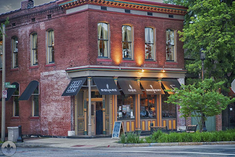
Our end point for Photo Flood 10 was Square One Brewery and Distillery. Makers of an excellent variety of craft beers and the lauded J.J. Neukomm Whiskey, the establishment also serves up some of the best fish and chips in the city (actually, the food was great all around). The restaurant, which occupies a corner building along Park Avenue, has lots of exposed brick and an intimate outdoor dining area.
photograph by Dan Henrichs Photography, St. Louis


[…] development in directions away from the older, more established neighborhoods of the city (like Lafayette Square) to newer, more fashionable areas (like the Central West End). However, the city was still among […]
[…] opulent and with less city intervention than the ones they were leaving behind, near Downtown, in Lafayette Square, or in Compton Heights. Furthermore, because these private places were new, the prejudices that […]
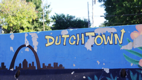
[…] from the same common pasture tradition as Lafayette Square, Benton Park is a historic St. Louis neighborhood notable for its unique topography and colorful […]
[…] is ongoing to ensure that the next chapter added is one of rebirth. From the previous success of Lafayette Square as a redevelopment project to the current re-envisioning of Cherokee Street as a creative district, […]
[…] when pockets of urban revitalization started to occur in areas of South St. Louis like Lafayette Square, Soulard, and Cherokee Street (all nearby Soulard Farmers Market), interest in buying things […]