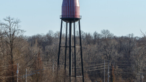
photograph by Barry Scroggin
North Riverfront is a large, industrial neighborhood that comprises essentially one third of St. Louis City’s northern riverfront development. Sandwiched between Riverview’s water treatment facility and the older manufacturers of Near North Riverfront, this neighborhood provides its businesses with modern infrastructure and convenient access to both I-70 and I-270, the railroads, and the river. Of St. Louis’ nine riverfront neighborhoods, this one is the largest, which is why we will be covering it in two visits.

photograph by Diane Cannon Piwowarczyk

photograph by Dave Adams

photograph by Ryan Stanley

photograph by Kathy Crabtree Brown

photograph by Dan Henrichs Photography, St. Louis
In 1764, St. Louis was founded along the Mississippi River along a southern section of the present day Jefferson National Expansion Memorial. For the next several decades, most of life in the settlement was centered along a few blocks close to the river; commerce, residences and what few industries there were (save for the farming conducted further afield) all developed alongside one another. During this time, a resident could easily walk almost everywhere that he/she needed to go within the village limits. In the 1800s, this approach began to change as the population of the city (and its commercial and industrial promise) grew. People were content with living further from the location of the original settlement and sometimes further from where they worked or shopped, a sentiment that increased as time passed. Today, most of St. Louis’ riverfront is industrial, and what little isn’t is generally parkland. Though there is a functional and material benefit to this (St. Louis was once the largest inland port in the country and one of the largest in the world), it is somewhat of a shame, since more areas of the St. Louis riverfront could have made for scenic places for people to live or great places for recreation (notable exceptions being the fantastic Riverfront Trail and the aforementioned Memorial).

photograph by Diane Cannon Piwowarczyk

photograph by Dave Adams

photograph by Barry Scroggin
North Riverfront, though one of the city’s largest neighborhoods, is not one with a particularly colorful or illustrious history. Up until the late 1800’s, it was predominantly undeveloped. In fact, it owes much of its modern existence to patterns begun by others.
In 1816, the city of North St. Louis was founded just to its south, and had aspirations of overshadowing the older namesake. This, of course, did not happen, and St. Louis eventually absorbed the younger city into its borders. Notably though, the great foresight in the planning of North Saint Louis’ riverfront as a commercial and industrial giant created a blueprint for the rest of the city’s river borders (north and south of Downtown). During this time in the history of the “industrial” riverfront, most workers lived near the factories where they worked, and so there tended to be a neighborhood vibe to these areas. Traces of this life are still easy to see in places like Carondelet, but they have been mostly erased or paved over by the highway elsewhere along the river.

photograph by Kathy Crabtree Brown

photograph by Jason Gray

photograph by Donna Burch
In the 20th century, North Saint Louis (now Old North Saint Louis) was cut off from its riverfront by the construction of interstate 70. Its industrial area adjacent to the river became known as Near North Riverfront, and remains at the center of the North Riverfront Business Corridor (the name for the special district comprising both Near North and North Riverfront). Still, despite lacking many historic structures, the North Riverfront neighborhood is not to be overlooked. In 2003, the St. Louis Development Corporation published its comprehensive plan to redevelop this district, with some prime additions planned for the North Riverfront neighborhood which already tends to have slightly more modern facilities than its cousins nearby.

photograph by Dave Adams

photograph by Ryan Stanley

photograph by Diane Cannon Piwowarczyk

photograph by Jackie Johnson
Today, exploring the neighborhood as a pedestrian is nearly impossible without crossing someone’s private property. This is to a large part why our group of images focuses so much on what is accessible there, the scattering of abandoned properties. To complicate things more, there is virtually no street parking anywhere to be found, and this is certainly by design of the industrial district designation. Nonetheless, if you get a chance to explore it, definitely do.

photograph by Ryan Stanley

photograph by Donna Burch

photograph by Jason Gray

photograph by Ryan Stanley
MAP:

Our endpoint for Photo Flood 45 was the Sun Cafe in Hyde Park (North Riverfront’s restaurants are primarily of the late-day drinking variety). This beautiful cafe is run by Sun Ministries as a profit generator for neighborhood revitalization, and from the looks of things, they are doing a great job! Delicious coffee and a friendly staff; we’ll definitely be back.

photograph by Kathy Crabtree Brown


