
photograph by Dan Henrichs Photography, St. Louis
“Stand looking west at the Gateway Arch and the St. Louis skyline. Today this is a major city and a metropolitan area of almost two million. Go back four hundred years. There sat a wooded hillside and little or no sign of human life. What is the story behind such a transformation?” -Frederick A. Hodes, from his book, Beyond the Frontier: A History of St. Louis to 1821
In mid-February of 1764, several boats landed upon the muddy bank of what would become the St. Louis Levee. They carried a crew of thirty men; most notable among them was Auguste Chouteau Jr. Fourteen years old at the time, Chouteau was the leader of the small group, and had been tasked by his employer (later, his father-in-law), Pierre Laclède, to establish a settlement upon the location. Laclède was a French-born merchant with some military experience and formal education. He and a partner in New Orleans formed Maxent, Laclède, and Company to control trade with the Native American tribes in the upper Louisiana Territory, so a settlement within the region appeared a strategic move. Little did either conceive upon how large their northern outpost would grow.

photograph by Mandi Gray

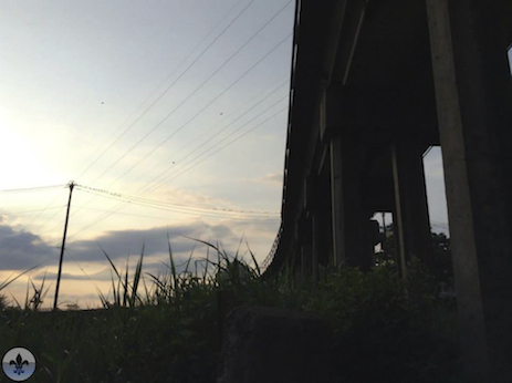
photograph by Steven Ley

photograph by Kieara Crisp

photograph by Ann Aurbach

photograph by Jeni Kulka
St. Louis grew slowly until after the War of 1812. The War helped to ease some of the British interference to trade originating from/through the city, and population began to expand rapidly as a result. Located near the conjunction of several major waterways (Missouri River, Illinois River, Mississippi River, and Ohio River), St. Louis fast became the most significant inland port in the country. Chief among exports in the early years was fur, but over time, this practice grew to include iron, coal, lead, and eventually manufactured products, such as shoes, beer, etc. If one were to study the current building topography of the city, it would be immediately noticeable that the majority of high-rise properties exist north of Market Street. There are a variety of reasons for this actuality, including that many buildings south of Market have been demolished, but the chief reason is trade. In the early days, almost every product shipped from St. Louis was sent by water. The area where Chouteau and his men landed eventually became a bustling warehouse district with access to the river provided by several wooden planks. Over time, the planks gave way to cobblestone, a necessity that improved conditions for the more than 100 steamboats queued along the riverfront. In time, however, railroad shipping began to usurp river traffic. Missouri was one of the earliest states to support the construction of a transcontinental railroad, championed locally and nationally by Senator Thomas Hart Benton, but an unfortunate combination of factors, including the Civil War (which raged throughout the state) and a tragic, railroad bridge failure at Gasconade, Missouri (that killed many local businessmen and civic leaders), delayed the construction of the railroad through St. Louis. This setback, of perhaps only a decade, allowed Chicago interests to stake their claim over the transcontinental rail project, forever changing the destinies of both cities. In 1874, Eads Bridge opened, finally allowing railroad traffic to cross the Mississippi River at St. Louis; this was almost twenty years after the first railroad bridge was constructed across the Mississippi at Rock Island, which connected the West to the East Coast, through Chicago. That Chicago would become the major metropolis of the Midwest was not entirely left to fate. In the 1800’s, New York City and New Orleans were the two largest ports in America, and engaged in something of a rivalry. St. Louis was directly connected to New Orleans, by origin and by river, so NYC needed to find an upperhand elsewhere. Concurrently, East Coast financiers began investing heavily into the infrastructure of Chicago (which had a waterway connection to both New York and the Mississippi River), and with control of the railroad, they were finally able to bypass St. Louis altogether. After the Eads Bridge was built, New York City businessmen continued to impede local growth. The robber baron Jay Gould, who had risen to prominence via Tammany Hall, purchased Eads Bridge for his railroad monopoly (he controlled over 10,000 miles of track) and levied high tariffs for anyone crossing it with freight. In 1889, St. Louis interests countered by building the Merchants Bridge further north, but lost it to Gould as well. It was not until 1909, that the city was able to permanently break the bridge monopoly over the Mississippi with the construction of the St. Louis Municipal Bridge, aka the “Peoples’ Free Bridge”. By this time, many local factories had already relocated to Illinois to avoid paying the freight tariffs, and Chicago had grown to become the second largest city in the country. Despite all this, St. Louis continued to prosper at its own rate until the 1960’s, when a different set of negating factors overtook it. Going back to the observation of St. Louis’ tallest buildings being grouped mostly north of Market Street, this is largely because the railroad exited nearby at Eads Bridge at the time that skyscrapers originated as an architectural invention.
photograph by Joshua Meyer

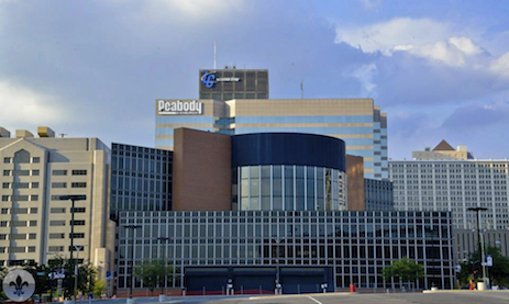
photograph by Jason Gray

photograph by Ann Aurbach

photograph by Mandi Gray

photograph by Steven Ley

photograph by Jason Gray
Nonetheless, the area south of Walnut Street is the focus of this Photo Flood, and it contains several important buildings and sites relating to the inception and growth of the city. The area known as “Chouteau’s Landing” (the actual site of Chouteau’s landing is further north, though adjacent) is comprised of several blocks of aged, industrial buildings, some of which are abandoned. These buildings, and those that comprise what’s left of Cupples Station, further west, made up an important warehouse and manufacturing district (and antecedent to the Washington Avenue corridor) that anchored production in the city for much of the first half of the 20th century. They attached to the railroad passing over Eads (and later on, the Merchants Bridge) by way of an underground terminus and a series of elevated connections. The St. Louis Municipal Bridge crosses the river at Chouteau’s Landing, evidencing the district’s former clout. Many of the buildings that remain, in both Chouteau’s Landing and Cupples Station, are considered city landmarks, and are on the National Historic Register. Just to the north of Chouteau’s Landing is a nice collection of Modernist buildings including the iconic TUMS Factory, the Stouffer’s Riverfront Towers (now Millennium Hotel I and II), Pet Plaza (now Pointe 400), and the Gateway Arch. The Jefferson National Expansion Memorial, the park surrounding the Arch, is situated upon the site of the original St. Louis settlement. Forty city blocks were razed for the construction of the Memorial, including a former warehouse of fur trader, Manuel Lisa, known as the Old Rock House. A possible boon for the neighborhood is the construction of “Ballpark Village”, which is currently ongoing. Situated across the street from Busch Stadium, Ballpark Village is a proposed mixed-use complex that will ostensibly include a museum and hall of fame for the St. Louis Cardinals baseball team, several bars and restaurants, and some private residences. Unfortunately, the only connected project that is currently finished is a massive parking lot, a structure of sorts that Downtown certainly does not need any more of. A U.S. District Court is also located in this area of town.
photograph by Captured N Time

photograph by Dan Henrichs Photography, St. Louis

photograph by Jason Gray

photograph by Joshua Meyer

photograph by Ann Aurbach
On a personal note, this post celebrates Photo Flood Saint Louis’ one year anniversary of our first Flood, which was also Downtown. We’ve explored much in our first year, but we have so much yet to see and do. If Photo Flood STL is to complete its mission of photographing every neighborhood in St. Louis, we will not finish until 2021. How’s that for a civic commitment? A sincere thanks to all of our readers, and for the community support that we have received thus far. We hope that you all are enjoying this site as much as we enjoy producing it. Here’s to photography in St. Louis and to what’s next!

photograph by Jason Gray

photograph by Janet Henrichs

photograph by Steven Ley
Map:

Our endpoint for Photo Flood 13 was BB’s Jazz, Blues, and Soups, an intimate performance venue and eatery. There, we saw the excellent Stacy Mitchhart Band play a fantastic set.

photograph by Jason Gray

photograph by Jeni Kulka


[…] 2. Photo Flood 13 […]
[…] (containing the original town settlement along the Mississippi). Last year, we photographed the southern section, an exciting amalgam of old and new construction. This July, having grown from a group of five to […]