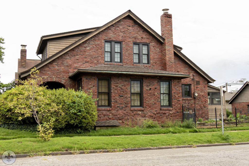
Photo Flood 7 Photo Flood 137
Author Archive for: Mike Matney
Photo Flood 137: Ellendale
Photo by Caren Libby It has been a long time since Photo Flood visited Ellendale. It was the 7th flood by the group, all the way back in February of 2013. The write up for the first visit can be found at http://www.photofloodstl.org/photo-flood-7-ellendale/ Photo by Mark Braun It definitely was...
Photo Flood 136: Forest Park Southeast
Photo by Dennis Daugherty Forest Park Southeast was first visited by Photo Flood St. Louis just over ten years ago in March 2015, which was flood 32. The northwest corner of the neighborhood “touches” Forest Park, thus where its name comes from. Photo by Anna Ratzlaff Forest Park Southeast...
Forest Park Southeast
Forest Park Southeast is a neighborhood of St. Louis, Missouri. It is bordered by Interstate 64 to the north, Vandeventer Avenue to the east, Interstate 44 to the south, and Kingshighway Boulevard and Forest Park to the west. Photo Flood 32 Photo Flood 136
Photo Flood 132: Clifton Heights
Photograph by Joe Rakers The neighborhood of Clifton Heights was first visited by Photo Flood STL nine years ago in July 2015. Clifton Heights is located in southwest St. Louis. Surrounding neighborhoods are the Hill, Ellendale, Dogtown, and Lindenwood Park. The article for the first visit is http://www.photofloodstl.org/photo-flood-36-clifton-heights/ Photograph by...
Clifton-Heights
The Clifton Heights neighborhood is located in southwest St. Louis. Photo Flood 36, July 25th 2015 Photo Flood 132, August 24th, 2024
Photo Flood 126: Collinsville
Photographer Mike Matney Home to the world’s largest ketchup bottle, Collinsville straddles Madison and St. Clair counties in Illinois; Belleville lies to the south, Edwardsville to the north, and is only 15 miles from downtown St. Louis. The city has a population of 24,366 according to the last census....
Collinsville
Collinsville is a city in St. Clair/Madison County Illinois, and is part of the St. Louis metro region. Photo Flood 126
Photo Flood 124: St. Louis Hills
Photographer Jim Harter St. Louis Hills is located in southwestern St. Louis. The first time Photo Flood STL visited the neighborhood was in August 2014. The boundaries are Chippewa Street to the north and northwest, Gravois Avenue to the southeast, and the St. Louis county border to the southwest....
St. Louis Hills
The St. Louis Hills neighborhood is bounded by Chippewa Street to the northwest and north, Hampton Avenue to the east, Gravois Avenue to the southeast, and the city limits to the southwest. Photo Flood 25 Photo Flood 124


